koh logo

Friday, December 29, 2006

Koh Samui, South Thailand

Koh Samui is located in the Gulf of Thailand in South China Sea in the Pacific Ocean. The island is a Amphoe or district in the Surat Thani Changwat or province. Samui is divided into seven Tambon or sub districts (administrative regions): Maenam, Bophut, Maret, Taling Nam, Namuang, Lipa Noi and Angthong. Koh Samui has been a backpackers destination since late 70's. Today, tourist from the whole world go to this easygoing paradise. It´s located in the Gulf of Siam and surrounded by more than sixty other islands, some small and inhabited, some bigger as Koh Phangan, Koh Tao (divers island) Koh Nang Yuan and Angthong Islands, the National Marine Park.
Beaches

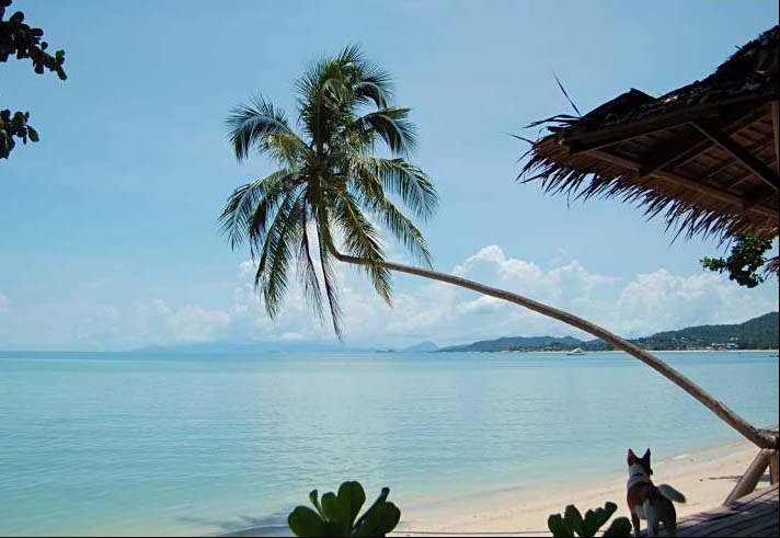
Chaweng A 7 km long beach in the North-East of Samui. The most well-known and developed, but also one of the best. You can rent anything from a simple bungalows to a five star hotel room here. There are plenty of high standard resorts here. The sand is invitingly white, but it can be a lot of people here, especially at high season.
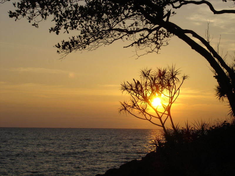
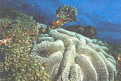
Lamai Not far as long as Chaweng but more quite and some people would say charming. The Southern part of the beach is somehow more inviting than the Northern, because there are not so much stones and corals there. Lamai is located in South-East of Samui, about 10 kilometers South of Chaweng. A little North of Lamai you will find Ao Tong Takian beach. It has became rather popular, and a few resorts are located there.
Maenam, Big Buddha, Bo Phut In the North of Samui you will find these fine beaches. You will also find the small but very beautiful Chong Mon beach in the North-East and Bang Por beach in the North-West. They are not as crowded as Chaweng and Lamai. A large range of hotels and bungalows are found here and it is close to the Airport, Pier(s) and Big Buddha too.
On Samui you can stay in anything from a rather spartan bungalow to a luxury hotel.
Waterfalls To be honest, you will not find a "Niagara looking" waterfall on Samui, but it can be a nice experience anyway.
Na Muang waterfall is located about 10 km south of Nathon. It is about 80 m high. You have to walk for a while to get here.
Hin Lad waterfall is located 2 km south of Nathon Town. Take a walk in the forest and enjoy a soft drink or why not a refreshing Thai beer afterwards.

Big Buddha Wat Phra Yai is a more than 12 meter tall Buddha statue, first built in 1972. It is located on a small island but today connected with main land with a bridge. Please show respect and wear proper clothes and shoes while visiting. This is not just a tourist attraction, but also an important Buddhist symbol for the local Thai people here. In 2005 and 2006, Big Buddha has been extended with a Dharma wheel and a traditional Suphannahong boat.
How To Go
Flight There are many daily flights from the International and domestic Airport in Bangkok; Suvarnabhumi Airport (opened in September 2006). Bangkok Air flies direct to Samui Airport. A flight schedule with Bangkok Airways is found here. Thai Airways flies to Suratthani. From there, just catch the bus or taxi to the ferry in Donsak.
Bus If you want a more economical way to travel, take the VIP bus from the well-known Khao San Road or from the Southern bus terminal at Boromrat Chonnani Road. The VIP buses are more comfortable than the so called A/C bus. You can buy a ticket in almost every travel agency in Bangkok. Ferry is often included in the price.
Train Another great way to travel is the night train from Hualamphong, the Bangkok railway station, to Suratthani. The sleeping cars are comfortable. It is a little more expensive than the bus, but you will get a good sleep. Upper beds are less expensive than the lower ones. A private "first class" cabin for two persons, is also available.
Ferry The fastest ferry leaves from the two main piers in Donsak on the main land with operators like Seatran, and Raja Ferry. The price is about 110 baht. You will see many of the small surrounding islands if you don't fall asleep. You might also take the Lomprayah ferry from Chumpon. On smaller ferries (like the Songserm ones) from other piers, you might be contacted by Thai-guys to convince you that "their" resort on Samui is great.


Saturday, December 23, 2006

Kho Phi Phi, South Beach


The twin Phi Phi islands, 30 miles (48km) east of Phuket, are world-renowned, particularly since the making of the Hollywood box office sensation, 'The Beach'. Phi Phi Leh, the smaller of the two islands, was the setting for this movie, which now draws scores of day trippers from Phuket, just a 45-minute boat ride away. The island has no accommodation and is accessible only by boat, but offers sensational snorkelling and the Viking Cave with wall paintings. Phi Phi Don, the larger island, has idyllic tropical beaches lining its shores. Ton Sai Bay is the main tourist centre on Phi Phi, a little overdeveloped for some tastes. Even being overrun by tourists, though, the islands retain their spectacular quiet beauty.


Phi Phi Islands Activities
Snorkelling

Wonderful coral gardens, unusual cave fish, exotic tropical fish, and sharks - probably the best snorkelling anywhere. Depths vary from 2-7 metres (6-20 feet) and visibility is crystal clear
Fishing
The Andaman Sea is home to all the classic prize fighters of the fish world. Black Marlin, Giant Travelly, Sailfish, and Shark.
Yellowfin, Dogtooth and Skipjack, Tuna are common, while Wahoo are plentiful during the monsoon season. (June - October.)
Rock Climbing
Trekking


Wednesday, December 20, 2006

Koh Lanta , South beach


Koh Lanta lies on the west coast of Andaman Sea in between Krabi and Phi Phi Island. Large Size Island with 6 km wide and over 30 kms long, 9 beaches lie from north to south along the sunset coast. Stunning scenery, fantastic white sandy beaches, coastlines have more than 70 small islands and plenty with forest, coral reefs and under water life. Koh Lanta consists of 52 islands that from the Southernmost district of Krabi province. The two largest islands are Koh Lanta Yai and Koh Lanta Noi. The other islands are many different-sized island, some of which are surrounded by beautiful coral reefs such as Koh Ha, Koh Rok and Koh Hai (or Koh Ngai). The main island in the park is Ko Lanta Yai, where both the District Headquarters and National Park Office are located. The island itself is generally rugged and mountainous. There are beaches both gravelly and sandy toward the south. The suitable time to visit Ko Lanta is from November to April.

How to Go
By Car:
From Bangkok
The distance from Bangkok to Krabi is approx 950 kms or about 12 hrs by car.
Route 1: Phetburi - Prachuabkirikhan - Chumporn - Phang Nga - Krabi = 946 kms.
Route 2: Phetburi - Prachuabkirikhan - Chumporn (Highway No 41) to Chaiya (Suratthani) - Krabi (Viangsra) - Highway No 4035 - Krabi (Ao Luk) and along Highway 4 again = 814 kms.

From Phuket
The distance from Phuket to Krabi is 176 kms along Highway No 402 and 4, about 2 hrs.


By Sea:
From Krabi:
Visitors can travel from Krabi to Koh Lanta via ferry during high season (Nov - Apr). The ferry departs from Klong Chi Lard Pier, which is about five kms from downtown Krabi. The ferry departs at 11 am and arrives at Saladan Pier on Koh Lanta 1pm. The return trip to Krabi at 8am. There is no ferry during low season (May - Oct).

From Phuket:
There are no direct regular ferries from Phuket to Krabi but it's possible for you to charter a boat from Phi Phi or Ao Nang. Ex: departing from Phuket at 8am to Koh Phi Phi at 11:30am charting another ferry at Koh Phi Phi (Tonsai Bay Pier) to Koh Lanta at 3:00pm.

From Koh Phi Phi:
About 3 hrs from Koh Phi Phi to Koh Lanta. During high season, there are two trips from Koh Phi Phi to Koh Lanta: 11:30am and 1pm.


Friday, December 15, 2006

Hat Chao Mai National Park


Hat Chao Mai National Park consists of land area and sea area, located in the western side of southern part of Thailand. It covers land area about 93.64 sq.km and sea area of Andaman sea in Indian ocean about 137.21 sq.km. This national park is divided into 2 parts, the first part is the coast land including Muk island, Kra Dan island, Wan island, Cheaung island, Pring island and Meng island. This area consists of a steeply high limestone mountain where the northern part of the eastern side has Chong Chan mountain, Kwan Med Chune mountain, Kwan Dang mountain, etc. where are the source of many streams which joins together at Bang Sak canal and drains to the Trang river. In addition, this national park also consists of grass field, rainforest, mangrave forest, beach forest and sand beach whereas sea area has the deep sea widely covered with coral reef along the steeply high shoulder of mountain. This coral reef would be found in the Waen island, Cheaung island and Kradan island.

Location and Journey
Hat Chao Mai National ParkMu 5, Ban Chang Lang, Mai Fad Sub-district,, Sikao, Trang, Thailand 92150Tel. : 0 7521 3260 Fax : 0 7521 3260
By Car
To reach the park leave Trang on the # 4046 road and head towards Krabi until the 30 km post is reached when you turn left onto the # 4162 road. This road is followed until you reach Pakmeng beach when the road turns left to run along the beach. This followed for about 7 km. to the headquarters is reached.
By Ship


Thursday, December 14, 2006

Khao Sam Roi Yot National Park


Located in the west of Thai Gulf, in the territory of Kuiburi District, Sam Roi Yot Sub District, Prachuap Khiri Khan Province. Khao Sam Roi Yot National Park is Thailand’s first coastal National Park in 1996, covering the area of approximately 98.8 sq.km. The landscape is high steep limestone mountains by the beautiful coast, matching with plain area stand by the sea, which are marshy beach and shallow sea pond. There are limestones islands nearby the coast e.g., Sattakut Island, Kho Ram Island, Nom Sao Island, Rawing Island, Rawang Island and Khi Nok Island. The flat area with stagnant water through the year on the west of the park is Thung Sam Roi Yot, which is the large freshwater marsh, covering around 36.8 sq.km.
The name Khao Sam Roi Yot can be translated into "The Mountain With Three Hundred Peaks", a series of magnificent grey limestone mountains, which rise dramatically from the Gulf of Thailand and adjacent coastal marsh to a maximum height of 605 m.


Location and Journey
Khao Sam Roi Yot National ParkMu 2, Ban Khao Daeng, Khao Daeng Sub-district,, Kui Buri, Prachuap Khiri Khan, Thailand 77150Tel. : 0 3261 9078 Fax : 0 3261 9078
By Car
Khao Sam Roi Yot National Park is located 63 km. South of Hua Hin, in Prachuap Khiri Khan Province.
Driving from Bangkok, take Highway #4 (Petkasem Road) to Pranburi (approx. 3.5 hrs.), and then it is a further 37 km to the headquarters. Turn left at Pranburi’s main intersection, drive 2 km, at which point the road forks right, continue for 2 km and turn right at the police substation. From here it’s 19 km to the park’s check post, and then another 14 km to the headquarters.
Driving from the south enter the park’s southern entrance off Highway # 4, 36 km past Prachuap Khiri Khan. Turn right at km. 286.5, at the sign which reads Khao Sam Roi Yot National Park and countinue 13 km to the headquarters.
By Bus
There are air-conditioned buses and regular buses service at the New South Transport Station going to Pranburi District, Prachuap Khiri Khan Province. At the point, Pranburi – Bang Pu, Bang Pu – Laem Sala, Pranburi – the park’s headquarter and Bang Pu – the park’s headquarter rental cars are on service.


Wednesday, December 13, 2006

Hat Wanakon National Park


Hat Wanakon is located on a narrow coastal plain which stretches from the mountains of the Tennessarim to the gulf of Thailand. The deposits are of Quaternary origin and consists of layers of material laid down in horizontal beds. The deposits are dominated by Quartz sands, with a partical size ranging from sand to pebbles. Some of the beds also have sandstone rock fragments. The particals in the beds show a degree of rounding probably produced by fluvial action. The degree of rounding, <40%>


Location and Journey
Hat Wanakon National ParkMu 7, Huai Yang Sub-district,, Thap Sakae, Prachuap Khiri Khan, Thailand 77130Tel. : 0 3261 9030 Fax : 0 3257 4558
By Car
Drives on the road no. 4, Petchakasem, from Bangkok to Prachub Kirikant, about 345 kilometers long, to Amphoe Tam Skare where far from Prachuap Khiri Khan Province about 23 kilometers.
By Train
You can take a train at Wang Duan station or Huay Yang and then get a car or a motorcycle taxi.
By Bus
Takes a normal bus from Bangkok to this national park which costs you about 150 baht or by a air-conditioning bus which costs about 210 baht.

Tuesday, December 12, 2006

Than Sadet - Ko Pha-ngan National Park


The Royal Forest Department has surveyed; Pha Ngan island forest of national forest reservation, Namtok Than Sadet forest, Khao Lat Kaeo forest, Khao Khai forest, Khao Ta Luang forest, Khao Hin Nok forest, Laem Pho–Laem Kata Khwa forest and Khao Fai Mai forest. Nowadays, in the processing has proclaim it to be a national park and using call of the name “Than Sadet – Ko Phangan National Park” , covers a total area of approximately 65.93 sq. km.
The weather condition is rainfall almost all year round. Average annual temperature around 28oC , highest temperature around 33oC in May (hot). The lowest temperature around 24oC between December and January, it making the climate cool down during the period. Average annual rainfall is measured at 1,848 millimeters, February is the lowest rainfall around 38 millimeters and November is the high rainfall around 428 millimeters.

Location and Journey
Than Sadet - Ko Pha-ngan National Park108, Mu 3, Ban Madueawan, Ko Phangan Sub-district,, Ko Phangan, Surat Thani, Thailand 84280Tel. : 0 7723 8275
By Ship
Express boat is middle boat, it to have a capacity for 150 persons, services 2 times daily. It takes around 4 hours for the journey.
Night boat is normal boat and transport goods, 2 steps , have capacity for 160 persons. Travel in night time, also provides a bed for total passengers, services 2 times daily. It takes around 8 hours for the journey.
Ferry boat is the large boat and transport goods, have capacity of passenger around 500 persons with car, truck or van around 50 vehicles. Services 4 times daily, it takes around 6 hours for the journey.
By Bus
The distance from Bangkok go to Surat Thani totaling 650 kilometers by;
Train fee is 80 baht
Air-conditioned bus fee is 400 baht
Standard bus fee is 200 baht The distance from Surat Thani to Pha Ngan island, by
Standard bus fee is 40 baht,
Air-conditioned bus fee is 80 baht
Regular route public wagon fee is 80 baht.


Monday, December 11, 2006

Mu Ko Chang National Park


Mu Ko Chang National Park is located in the southeastern region of Thailand close to the border with Cambodia. The island runs parallel to the coast and appears very mountainous from the shore due to the mountain ridge which runs the length of the island. The ridge is composed of several summits the tallest of which are Khao Lan, Khao Chom Prasat, Khao Khlong Mayom, Khao Salak Phet and Khao Yai, which is the highest peak reaching 743m above sea level. The rock of the island is mainly Granitic and dates from approximately around 200 million years ago. The geology produces a very mountainous island, but with rounded slopes rather than sheer cliffs. The island of Ko Chang has many streams and rivers which are fed by the rainfall collected on the mountainous slopes of the island. Due to the great amount of rainfall here these streams are very clean and supply water all year round. The principle streams on the island are Khlong Son, Khlong Mayom, Khlong Khangkhao, Khlong Bang Bao, Khlong Phrao, Khlong Nonsi and Khlong Chaiyachet. This mix of mountains and streams produces some very beautiful waterfalls the most notable of which are Than Mayom, Khlong Phlu, Khlong Nonsi, Khiri Phet and Khlong Nung Waterfalls.
Location and Journey
Mu Ko Chang National Park23/7, Mu 3, Ko Chang Sub-district,, King Amphoe Ko Chang, Trat, Thailand 23170Tel. : 0 3955 5080 Fax : 0 3955 5080
By Car
Only 312 kilometers from Bangkok to Trat (Highway No 3). The bus fee is 157 baht for a fan bus and 194 baht for air-conditioned bus. It takes 17 kilometers from Trat to Laem Ngop dock. The bus fee from Trat to the dock is 12 baht. The ferry departure point is also available at “Center point” and “Ao Tham Ma Chat” where you can reach the island at Than Mayom dock, Dan Kao dock or Ao Sap Pa Rot dock. It takes 40 minutes from the mainland to the island. There’s ferry to Ko Chang every hour. The fee is 50 baht. When you’re there you can go to all part of the island by local bus.
By Bus
To get to the islands from Bangkok a bus should be taken from the eastern bus station(Ekkamai) on Sukhumvit road or North/northeastern terminal(Mochit Mai) to Trat province. Once in Trat town a taxi will take you to the ferry terminal at Laem Ngop which is 17 kms from Trat town. The ferry goes to several locations on the island so the trip to your chosen destination can take anything from 40 minutes to 5 hours, depending upon where you wish to get off and how busy the boat is. Travel around the islands is relatively easy with Jeep taxis and motorcyle taxis. The tracks are also suitable for walking.


Sunday, December 10, 2006

Mu Ko Ang Thong National Park


Mu Ko Ang Thong National Park is an archipelago in the gulf of Thailand consisting of 42 separate islands, the principle islands being;Phaluai, Wua Ta Lap, Mae Ko, Sam Sao, Hin Dap, Nai Phut and Phai luak. All the islands occur in Ang Thong district, of Amphur Samui, Surat Thani province. The park covers a total area of 102 sq.km of which about only 18 sq.km is land. The National park does not encompass the entire island chain, its jurisdiction covers about 82% of the total area. The park was established on 12th November 1980.


During monsoon (November and December) in the Gulf of Thailand always have big waves and windy. Traveling to Ang Thong National Park, Surat Thani Province is not safe. Thus, National Park office announced for temporary closing during 1 November - 23 December every year.


Location and Journey
Mu Ko Ang Thong National Park145/1, Talat Lang rd, Talat Sub-district,, Muang Surat Thani, Surat Thani, Thailand 84000Tel. : 0 7728 6025, 0 7728 0222 Fax : 0 7728 6588
By Car
Use national road number 35 (Thonburi-Paktho) from Bangkok to national road number 4 pass Phetchaburi province, Chumphon province, and Prachuap Khiri Khan province to national road number 41 to Surat Thani province, approximately 644 kilometers. (The bus fare = 211 Baht, and air-bus fare = 295 Baht.) Go on to Donsak District and on board a ferry from Donsak District for another 60 kilometers
By Airplane
By Thai Airline Public Co, Ltd. from Bangkok to Surat Thani province. The airfare is 2,055 Baht.By Bangkok Airway Co, Ltd. from Bangkok to Samui Island. The airfare is 3,180 Baht. There is return flight every day, and about 1:15 hour a trip.
By Ship
Traveler can set off from Samui Island to Mu Ko Ang Thong National Park about 35 kilometers with 550 Baht a person by taxi-boat (tour boat). And, traveler can hire a speedboat from Samui Island to the national park with 4,000-5,000 baht for 10 persons. Also, traveler can hire a tour boat from Surat Thani province to the national park with 12,000-12,000 Baht for 70-100 persons.
By Train
Use the train everyday from Bangkok (Hua Lam Phong) to Phunphin Train Station, and take a bus to Surat Thani Province and go further by bus of Surat Thani – Samui Island.
By Bus
Take a bus from Surat Thani to Ko Samui District about 84 kilometers with the bus fair = 100 Bath, and the air-bus fair = 120 Baht a person. Then take a speedboat of Songserm Travel Center Co, Ltd. from Thatong Seaport, Surat Thani Province to Na-Thon Seaport, Samui Island, with two trips a day The departure times are at 07.30 AM. and 02.30 PM. from Thathong Seaport, and at 07.15AM. and 02.15 PM. from Na-Thon Seaport. For regular boat (sleeping boat), at 11.00 PM. from Ban-Don Seaport, Surat Thani Province, to Samui Island at 05.00 AM. And at 09.00 PM. from Samui Island to Surat Thani Province at 04.00 Am.

Saturday, December 9, 2006

Thale Ban National Park


Thaleban National Park was declared as the 20th National Park in Thailand on 27th October 1980. The park encompasses a total area of 196km2. Thaleban is approximately 1,000 km south of Bangkok, in the province of Satun. The park covers the mountainous border area between Satun province, Thailand and Perlis state, Malaysia.
Talaybun National Park is situated between Kwuan Doan District and Muang District, Satun Province, with the following adjacent territory

facing Tu Yoh Canal, Tambon Wangprachan, Kwuan Doan District, Satun province
bordering Sadao District, Songkhla province
bordering the Malaysian State of Perlis
facing the Andaman Sea, Indian Ocean

Satun province is normally affected directly by the South-Westerly wind from the Indian Ocean in May through to October and just when the South-Westerly wind is weakening North-Easterly wind from China will move in. However, since Satun province is situated on the west side of the shore line no direct impact from the North-Easterly wind is found, though, during October through to November, there could be certain amount of rainfall which will start decrease accordingly. During December to March, the weather can be quite dry due to the South-Easterly wind which will cause an increase in temperature during these months.

Location and Journey

Thale Ban National Park
Mu 4, Samankarat Burin rd, Wangprachan Sub-district,, Khuan Don, Satun, Thailand 91160
Tel. : 0 7472 2736-7 Fax : 0 7472 2730

By Car
From Bangkok, take Petchakasem Highway to Suratthani then take Highway No. 4 to Rattaphum District, Songkhla province then take Highway No.406 to Kuan Doan District then take the Thai-Malaysian Border Road No. 4184.


By Airplane
There is no direct flight to Satun. The trip by air can be made via Hat Yai Airport then taking a Hat Yai – Satun van to Kuoan Sator junction. The van leaves every hour from 6:00 a.m – 7.00 p.m. at 60 Baht/person. Buses from Hat Yai – Satun leaves every 15 minutes from 6:00 a.m. – 6:30 p.m. at 38 Baht/person for air-conditioned bus and 35 Baht/person for standard bus.


By Train
Visitors can take a Bangkok-Hat Yai train and get off at the Hat Yai Train Station, continue on to the National Park as by Car.


By Bus
There are buses from Bangkok to Satun daily and the distance from Bangkok to Satun is 973 kilometres or approximately 11hours. The cost for standard bus is 556 Baht.


Friday, December 8, 2006

Tarutao National Park


Tarutao and the west coast of peninsular Thailand are subject to a monsoon climate. In the summer months high temperatures in central China cause the air to rise, thus creating a massive low pressure area. This draws wind from the cooler area over the Indian Ocean. The winds coming off the Indian Ocean pick up moisture and dump heavy rains on the west coast of peninsular Thailand from May through October. Normally 250-400 mm. of rain falls in each of these months. The other six months of the year receive little or no rain. Total yearly rainfall averages about 2500 mm. The monsoon winds make boat travel dangerous from May through October; that is why visitors are encouraged to come to the park from November through April.

The mean yearly temperature is between 27 and 28 degrees C. The warmest month of the year is April, with the April mean about 29 degrees C. High temperatures in April may be 35 degrees C. or more. November and December are the coolest months of the year with mean temperatures of about 15 degrees C.

The mean yearly humidity is about 80%. It is highest in September, October and November and averages about 85%. Humidity is lowest in February and March, varying from 70-72%. The climatic data recorded here was not taken on Tarutao. It is based on data actually collected at Phuket and Trang, and is thus not completely accurate. But it is unlikely that the actual values for Tarutao would be much different.

In rainy season, the national park will be closed (Adang - Rawi Islands) during 16 May - 15 November every year for visitors safety.

The history of Tarutao is tied to the history of democracy in Thailand. The need for an isolated and forbidding environment to lock away enemies of the state caused the Corrections Department to build a penal colony there in 1939.Two important revolutionary groups were imprisoned here: the Bowondet coup group and the Petty Officers' coup group. Their coup attempts were unsuccessful, but ushered in change nonetheless, and soon a democratic constitution was drafted.The first prison was located at Talo Udang Bay, but hundreds of new prisoners came every month, so Talo Wao Bay became the second site. Prisoners were forced to build a road 12 km. long and 6 m. wide between the two bays.From interviews of old guards and prisoners, it was learned that almost 1/3 of the convicts died on the island. Malaria was the main cause of death; but cruelty from guards and starvation were also other major factors.

Location and Journey

Tarutao National Park
Paknam Sub-district,, Langu, Satun, Thailand 91110
Tel. : 0 7478 3485, 0 7472 8027-8, 0 7472 9002-3 Fax : 0 7478 3597

By Bus
There’re 465 km. from Bangkok to Had Yai. From Had Yai, you can go to Pak Ba Ra ferry departure point by Had Yai – Ra Ngoo taxi or take mini bus from La Ngoo to Pak Ba Ra. You can even take the coach or local bus from Had Yai to Pak Ba Ra.


Thursday, December 7, 2006

Mu Ko Phetra National Park


The park is situated on the Andaman sea coast in Satun and Trang provinces. It consists of an area of coastline and over 30 islands. The park has many diverse habitats including; open water, coral fringed islands, sandy beaches, forest covered islands to sheer rocky islands which rise steeply out of the sea. There are also a few patches of mangrove forest, beach forest and tropical forest. The islands within the park are small the largest being Khao Yai Island which is about 4.7 sq.km in area. The sea area of the park includes many important fishing grounds for this reason many of the islands act as temporary refuges for fishing boats during monsoon storms.

Location and Journey

Mu Ko Phetra National Park
298, Mu 4, Ban Talo Sai, Paknam Sub-district,, Langu, Satun, Thailand 91110
Tel. : 0 7478 3074, 0 7478 3504 Fax : 0 7478 3504

By Car

From Bangkok, take Highway No. 4 past Prachuap Khiri Khan and Chumphon then take Highway No. 41 to Nakhon Si Thammarat and Phatthalung. From Phatthalung, drive on to Rattaphum District, Songkhla then take Highway No. 4 and turn right to Highway No. 406. It is 973 kilometres from Bangkok.


By Airplane

There is no direct flight to Satun. The trip by air can be made via Hat Yai Airport then taking a taxi or public bus to Satun for 97 kilometres.


By Train

Visitors can take a Bangkok-Ya La or Bangkok-Hat Yai train and get off at the Hat Yai Train Station, then take a taxi from Ratthakan Post Office to Satun. It is 97 kilometres from Hat Yai to Satun. Vans and public buses are also available. Transportation from Hat Yai Train Station is operating daily, departing every hour starting from 6:00 a.m. – 4:00 p.m. Normal buses (Hat Yai –Pakbara–Satun route) from Hat Yai Clock Tower are also operating 3 times daily starting from 7:00 a.m. – 3:00 p.m.


By Bus

The distance from Bangkok to Satun is 980 kilometres. The cost for standard bus is 450 Baht and 580 Baht for air-conditioned bus.

The distance from Satun to Phetra Islands National Park is 60 kilometres. The cost for standard bus is 33 Baht and 50 Baht for taxis.


Wednesday, December 6, 2006

Mu Ko Surin National Park


Surint Islands comprise of five main islands, including 2 large islands consisting of the northern surint island and southern surint island which located very adjacent like the twin island. They are separated by the 200 meters width shallow sea. In the low tide period, you can walk across to the other island or so-called "cutted channel bay". The other three islands are the rock islands with some dwarf trees. Plants that found here are the rainforest plants. They are one source of the big and best fertile shallow coral reef of Thailand
Could be classified into 2 seasons consisting of hot seasons starting from mid of February - May, while the raining season starting from mid of May till October which has a highest level of rainfall. The yearly average rainfall is more than 3,000 milimeters and the average of related humidity is 83 percent. In rainy season, the national park will be closed during 16 May - 15 November every year for visitors safety.

Location and Journey
Mu Ko Surin National Park
Khura Sub-district,, Khuraburi, Phangnga, Thailand 82150
Tel. : 0 7649 1378, 0 7649 1582 Fax : 0 7649 1583

By Car
Drives on the road no. 4 (Phetkasem Rd.) from Bangkok to Amphoe Khuraburi which is about 720 kilometers long then turns to Khuraburi Port at milestone no. 721, about 6 kilometers prior to Amphoe Khuraburi. From this intersection about two kilometers, you would see the entrance sign board of Mu Ko Surin National Park on the right-hand side, then make a turn to the tourist service center which located in the area of national park office.


By Airplane
Takes a plane to Ranong Airport or Phuket Airport, then takes a car to Amphoe Khuraburi of Phang Nga province.


By Ship
At Khuraburi - Mu Ko Surin Port, you can take a private tour boat which controlled by the national park and serves tourists everyday. The cost for round trip is 1,100-1,700 baht per person. This tour boat departs from Kuraburi Port at 09.00 am. everyday and arrive at the National Park Headquarters unit on Northern Mu Ko Surin at 11.30 pm. From the port to this islands is about 60 kilometers which takes about 2.30 hours of journey. The return boat from Mu Ko Surin to Khuraburi Port departs at 13.00 am. everyday. However, this service would be closed at May 16 every year because entering of raining season.


By Bus
Starts from the New Southern Bus Terminal at 7.00 pm which would arrive at Khuraburi about 5.00 am. Bus fare is 480 Baht/person. From the Bus Terminal, in Amphoe Khuruburi about 10 kilometer, you can take a motorcycle or rental car to the Khuraburi Port area, the location of Mu Ko Surin National Park Office. Motorcycle fare is about 50 Baht/person while a rental car cost you about 200 Baht/person

Tuesday, December 5, 2006

Mu Ko Similan National Park


Consists of numerous islands with high and steep granite mountain, beaches and rocks formation of many shapes. The shoreline of each islands are of inconsistent curves since they are situated in the outer part of the sea and are worn away directly by waves. Part of the water lies in the Andaman Sea and eastern side of the Indian Ocean while the shoulder of the continent borders the western shoreline of Phang Nga province and Union of Myanmar, paralleling the Nikobar Islands of India. There is no mud at all along the beaches, so the sands are very clean, white and very fine. Some islands do have hills in the area, which are usually quite tall with the highest top of 244 meters above mean sea level, while some islands are of flat area surrounded by sand dunes and coral reefs.


Mu Ko Similan National Park has been rated first by the U. S. publication Skin Diving of the top ten dive sites in the world. The Similan Islands in the heart of the Andaman Sea are indeed unparelled in their exotic beauty. If planning a visit, keep in mind that anytime between December to April is recommended, with the best month being March, because the monsoons are over and the water is clear.

Location and Journey
Address
Mu Ko Similan National Park93, Mu 5, Ban Thaplamu, Phetkasem rd, Lamkaen Sub-district,, Thai Muang, Phangnga, Thailand 82210Tel. : 0 7659 5045 (บนฝั่ง), 0 7642 1365 (บนเกาะ 4) Fax : 0 7659 5210
By Car
There are daily bus services from Bangkok to Phang Nga (approximately 788 kilometres)
Standard bus fee is 357 Baht, air-conditioned bus fee is 459 Baht, and VIP air-conditioned bus fee is 685 Baht.Then another 65 kilometres from Phang Nga to Thap Lamu District, it cost 35 Baht. for Motorbike can then be taken to continue on to Thap Lamu Pier (another 5 kilometres) at 30 Baht.
By Airplane
Flights from Bangkok-Phuket operate daily at 2,300 Baht. From Phuket, take a bus to Thap Lamu Pier, Phang Nga province then take a ferry to Mu Ko Similan National Park.
By Ship
Thap Lamu Port to Mu Ko Similan National Park, you can take a private tour boat which controlled by the national park and serves tourists everyday. The cost for round trip is 1,500 - 2,300 baht per person. This tour boat departs from Thap Lamu Port at 08.30 am. in everyday. From the port to this islands is about 70 kilometers which takes about 3.5 - 4 hours of journey. The return boat from Mu Ko Similan National Park to Thap Lamu Port departs at 13.00 pm. and 15.00 pm. in everyday. However, this service would be closed at May 16 every year because entering of raining season. Once reached Ko Similan, motorboats are available for tourist to get to different islands per the following fare


Monday, December 4, 2006

Mu Ko Ra - Ko Phra Thong National Park


In general, the area, located the west of Phangnga Province, consists of sinking seashore and productive mud-beaches on estuaries of many long rivers. The area is influenced by ebb and high tide of the sea. There are high mountains and islands lie north and south such as, Ra Island with the mountains about 235 meters above sea level, Phra Island with plain area, Kho Khao Island with high mountain about 310 meters above sea level, and many small islands such as Pling Island, Tachai Island and Bosai Island which has the highest mountain about 450 meters above sea level.
Location and Journey
Mu Ko Ra - Ko Phra Thong National Park
Ko Phra Thong Sub-district,, Khuraburi, Phangnga, Thailand 82150
Tel. : 0 7649 1378, 0 7649 1582
By Car
Be able to go there by cars, from Bangkok by using a superhighway number 4 as far as Kuburi District then going to the piers for traveling to other islands.
By Ship
There are many piers such as Nang Yon Pier; nearby Visitor Center of Mu Ko Surin Nayional Park, Ban Nam Khem Pier in Takuapa District where can go to Ko Kho-Khao for only 30 minutes, Ban Tung La-ong Pier where can go by a long-tail boat to the south of Ko Phrathong for 20 minutes and to the north of Ko Kho-Khao for 20 minutes.


Friday, December 1, 2006

Mu Ko Chumphon , South Island


The Chumphon area is popular with Bangkok residents as it is the Gulf’s nearest southern diving destination offering a wide selection of attractions, both natural and man-made, including spectacular beaches, over 40 perme-able-limestone islands, picturesque landscapes featuring waterfalls, caves and holy shrines. The other main islands in the group are; Ko NgamYai (east Cliff Rocks, Ko means island), Ko Ngam Noi , Ko Kalok , Ko Thalu , Ko Lak Ngam , Ko Samet , Ko Mattra, Ko Maphrao , Ko Lak Raet, Ko Lawa, Ko Kula , Ko Rang Ka Chiu , Ko Klaep , and Ko Khram.

Some parts of the park are included several hills eg. Khao Phongphang, Khao Bo Kha and Khao Chom Hiang where the highest peak located at the elevation of 255 m above MSL. Mu Ko Chumphon National Park covers a total area of 317 sq.kms. It also covers 70 km of the coast which includes sandy beach and mud flat. The park is relatively close to Chumphon town located 30 kms east in Hat Sai Ri.

Location and Journey
Address
Mu Ko Chumphon National Park
Mu 5, Ban Phong Phang, Hat Sairi Sub-district,, Muang Chumphon, Chumphon, Thailand 86120
Tel. : 0 7755 8144-6 Fax : 0 7755 8145

By Car
follow Highway No.4 (Phetkasem Road). Turn left at Pathomphon Inter-section for 8 km to reach the town, and then turn right at the clock tower onto Route 4001 (Chumphon-Pak Nam Chumphon). Before Pak Nam Chumphon, turn right to Hat Sai Ri for 20 m and then turn right again for another 8 km. The park’s headquarters is on the right.

By Airplane
At present, Chumphon has an airport to serve you. This airport is located in Amphoe Patiew, Chumphon province.

By Train
It takes time about 8-9 hours, depending on type of trains. You can choose to go with any train either day-time or night-time because it has many trains to go there everyday. Please get it at Bangkok station or Thonburi station.

By Bus
Takes a bus for Bangkok-Chumphon (500 kilometers) at the new southern bus terminal. Bus fare cost about 162 baht for a normal bus, 272 baht for an air conditioning bus and 15 baht for a bus to this national park which far from the bus stop about 23 kilometers