

The Royal forest department had surveyed and established the 75 million-year shell cemetery (Susan Hoi), Hat Noppharat Thara - Mu Ko Phi Phi and near-by islands in Nong Thale sub-district, Ao Nang sub-district, SaiThai sub-district and Pak Nam sub-district of Amphoe Mueang Krabi, 389.96 sq.km, as the 47th National Park of Thailand so called "Hat Noppharat Thara-Mu Ko Phi Phi National Park". There after, it had been expanded to cover the shell cemetery and near-by islands, 0.02 sq.km. After that the area of Nong Thale sub-district, Amphoe Mueang Krabi, Krabi province which is the area of the Royal Thai Navy and the Royal Palace area has been excluded from this national park and left only 387.90 sq.km.
Geographical Features
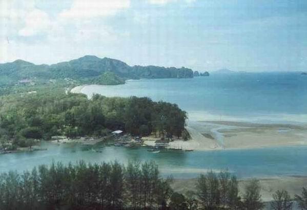
Consists of the land area on the coast of the island such as Ao Nammao mountain area, Ao Nang-Hang Nak forest and other islands. The geological form of this area is the high mountain laid along the northwest-southeast direction. Coast area is the high mountain while the western side has deeper slope than the eastern side. Geological form of sea coast area and islands in Andaman sea would be affected by the line of earth layer movement so called "Indosenia Teotonic Movement". At the area of mangrove forest of Hang Nak mountain you would find the Klom mountain canal on the coast rim which get the drained water from a big pond, so called "Nong Thale" (Sea Pond) and originates the mangrove forest and low plain area of the Samed forest in the area of national park office namely "Khlong Haeng" (Noppharat Thara Beach).
Weather Condition
"Hat Noppharat Thara - Mu Ko Phi Phi National Park is influenced by tropical monsoon wind. During November-October would has the southeastern-monsoon wind drives through and induces to have two seasons of weather here; the first is raining season starts from May till December and the hot season starts from January till April. Average temperature here is about 17 - 37 degrees celsius. Average rainfall per year is about 2,231 milimeters which would be highest in July and lowest in February.

Location and Journey
Geographical Features
Consists of the land area on the coast of the island such as Ao Nammao mountain area, Ao Nang-Hang Nak forest and other islands. The geological form of this area is the high mountain laid along the northwest-southeast direction. Coast area is the high mountain while the western side has deeper slope than the eastern side. Geological form of sea coast area and islands in Andaman sea would be affected by the line of earth layer movement so called "Indosenia Teotonic Movement". At the area of mangrove forest of Hang Nak mountain you would find the Klom mountain canal on the coast rim which get the drained water from a big pond, so called "Nong Thale" (Sea Pond) and originates the mangrove forest and low plain area of the Samed forest in the area of national park office namely "Khlong Haeng" (Noppharat Thara Beach).
Weather Condition
"Hat Noppharat Thara - Mu Ko Phi Phi National Park is influenced by tropical monsoon wind. During November-October would has the southeastern-monsoon wind drives through and induces to have two seasons of weather here; the first is raining season starts from May till December and the hot season starts from January till April. Average temperature here is about 17 - 37 degrees celsius. Average rainfall per year is about 2,231 milimeters which would be highest in July and lowest in February.

Location and Journey
Address
Khao Lak-Lam Ru National ParkMu 7, Khuek Khak Sub-district,, Takua Pa, Phangnga, Thailand 82190Tel. : 0 7648 5243 Fax : 0 7648 5414
By Car
You can drive from Bangkok on the road no. 4 (Phetchakasem Road) until arrive at Khao Lak-Lam Ru National Park which located only 50 meters from the road. Please notice Pho Ta Khao Lak spiritual house which be respected by local people.
By Airplane
Fly to Phuket international airport and take a bus to the Khao Lak-Lam Ru National Park by using the Petchakasem road direct to Amphoe Thai Muang.
By Bus
Takes a bus at the southern bus terminal, select one of an air conditioning buses or normal bus routed from Bangkok-to-Phuket and Bangkok-to-Takuapa or Bangkok-to-Phang Nga which cost you about 357 baht for a normal bus, 459 baht for an air condition bus and baht 685 for a special air condition bus.
No comments:
Post a Comment